

AI vegetation analysis (AI VRA)
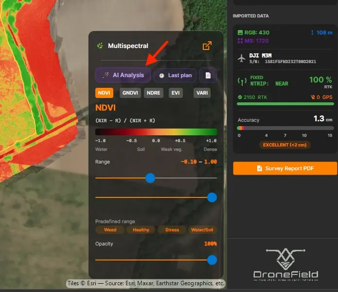
AI vegetation analysis turns a multispectral survey into a ready variable-rate plan in a couple of minutes. The AI analysis button on the vegetation index panel opens a short wizard; the Luna assistant then selects the most suitable index, zones the field, proposes per-zone doses with an agronomic explanation, and produces a PDF report.
Prerequisites
Section titled “Prerequisites”The AI analysis button is active only when all of these are met:
| Requirement | Details |
|---|---|
| Multispectral project | Mavic 3 Multispectral or P4 Multispectral imagery. On RGB-only projects (P4R, M3E, Zenmuse P1) the button is disabled. |
| Active subscription | See Subscription. |
| Field boundary | If the project has none, DroneField offers to create one with AI Boundary. |
| Internet connection | The analysis runs on the DroneField server. |
Monthly quota
Section titled “Monthly quota”Each device includes 10 analyses per month (your administrator can adjust this). A credit is spent only on a successful analysis — if the run fails with an error, your quota is untouched.
The wizard, step by step
Section titled “The wizard, step by step”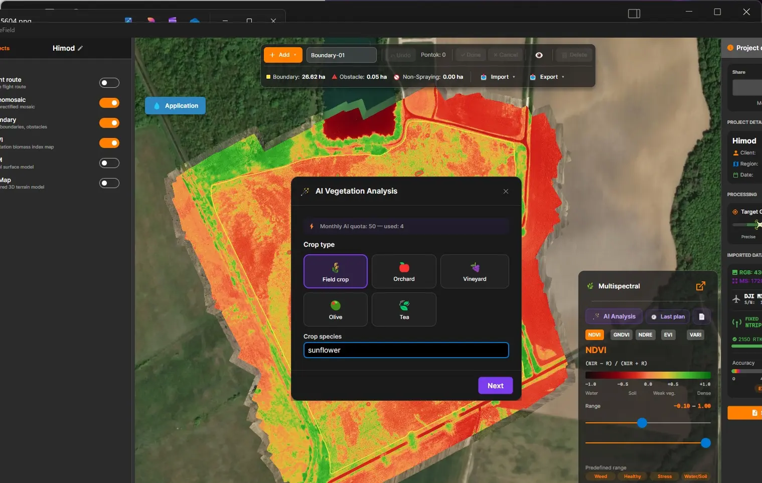
1. Crop
Section titled “1. Crop”Choose the cultivation type — field crop, orchard, vineyard, olive or tea — and the specific crop species. The species is mandatory for field crops and orchards: it is the key input of the phenological analysis.
2. Sowing date or plantation age
Section titled “2. Sowing date or plantation age”Optional — if you skip it, the AI estimates the growth stage from the survey date and location. You can also enter the plant count per hectare to refine the yield estimate.
3. Treatment type
Section titled “3. Treatment type”- Foliar fertiliser (liquid)
- Fertiliser granulate (solid)
- Desiccation
- Weed-patch treatment
4. Applicator machine and application volume
Section titled “4. Applicator machine and application volume”Select drone or ground rig, then enter the application volume (l/ha — or kg/ha for granulate).
The result
Section titled “The result”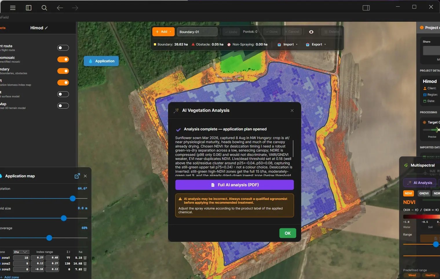
When the analysis finishes:
- the panel switches to the index Luna selected, with a matching display range;
- the application map opens automatically with the proposed zones — at most 5, where a 0 l/ha zone means no treatment needed (exported to ABZ / DJI as a non-spray polygon);
- small isolated cells are merged into the surrounding zone automatically, so the plan stays flyable.
You can edit everything afterwards — zone doses, ranges, grid — the AI result is a starting point, not a locked plan.
Zoning by living-vegetation share (desiccation, weed patches)
Section titled “Zoning by living-vegetation share (desiccation, weed patches)”For desiccation and weed-patch treatment, zoning is not based on a cell’s average index value but on the share of living vegetation inside the cell.
The reason: an average cannot tell a cell that is “30% still green + 70% dried down” apart from a uniformly half-dry stand — yet the first one needs treatment. In these plans the report’s zone table shows a “Living vegetation” column (in %); the index range shown below it is informational only.
Plan audit
Section titled “Plan audit”A yellow warning box may appear on the result page — for example “the field is nearly uniform” or “an untreated zone borders a treated one too closely”. This is not an error: it is a statistical sanity check that flags anything the approving expert should look at twice.
PDF report
Section titled “PDF report”The PDF report button generates a shareable document containing:
- Luna’s analysis and agronomic reasoning
- the index map
- the zone table with planned and actual index ranges (for desiccation and weed-patch plans, with the Living vegetation column)
- a yield estimate, when one can be given reliably
- general nutrient guidance (foliar treatments only — this is guidance, not a deficiency diagnosis)
- an expert approval signature block
An orange “Check before approval” box may appear under the zone table — for example when living vegetation remains in the untreated zone, or a zone ends up empty. Like the plan audit, it supports the expert’s sign-off; it is not an error.
The Last plan button reloads your most recent analysis at any time.
The report also travels with a shared project: the recipient opens it in the browser with the AI Report button — no DroneField installation needed.
Errors and quota questions
Section titled “Errors and quota questions”| Symptom | What to do |
|---|---|
| Timeout | The server may still have finished the analysis. Check your quota first — if a credit was spent, reopen the result with Last plan instead of rerunning. |
| ”Try again” error | The run failed on the server; no credit was spent. Run the analysis again. |
| Button disabled | Check the prerequisites — most often the project is RGB-only or the boundary is missing. |