

Project sharing
Project sharing publishes a read-only, browser-based view of a project — no DroneField installation needed on the other end. Send the link to your client to show the survey results, or to the spray-drone pilot, who can download the application plan directly from it.
The feature is available to every subscriber. The annual subscription includes 25 shares per user.
Creating a share
Section titled “Creating a share”Two prerequisites: the project needs a finished orthomosaic (sharing becomes available once processing is done), and an internet connection — the upload goes to the DroneField cloud, so sharing is not available offline.
- Open the project’s detail sheet in the desktop application.
- Click the Share button.
- DroneField uploads the project’s current state to the cloud:
- Orthomosaic
- NDVI
- Boundary
- Obstacle zones
- Non-spray zones
- After the upload you can optionally set a password for the share.
- On success the system generates a unique link, e.g.
https://share.dronefield.app/TFA5Huo6ud.
Copy the link and send it to anyone — client, colleague, pilot.
What does the recipient see?
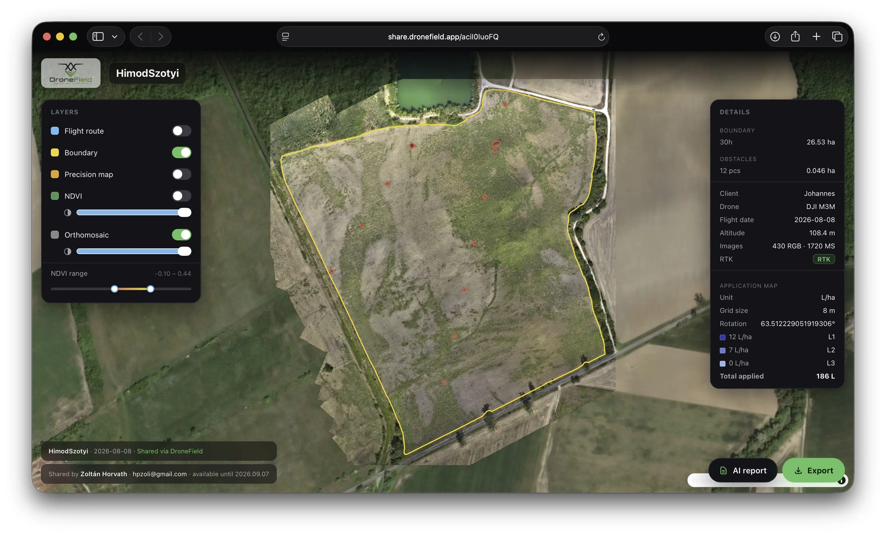
Section titled “What does the recipient see?”The link opens in any modern browser. The web view shows:
- The orthomosaic (with opacity slider)
- The NDVI layer (with adjustable NDVI range)
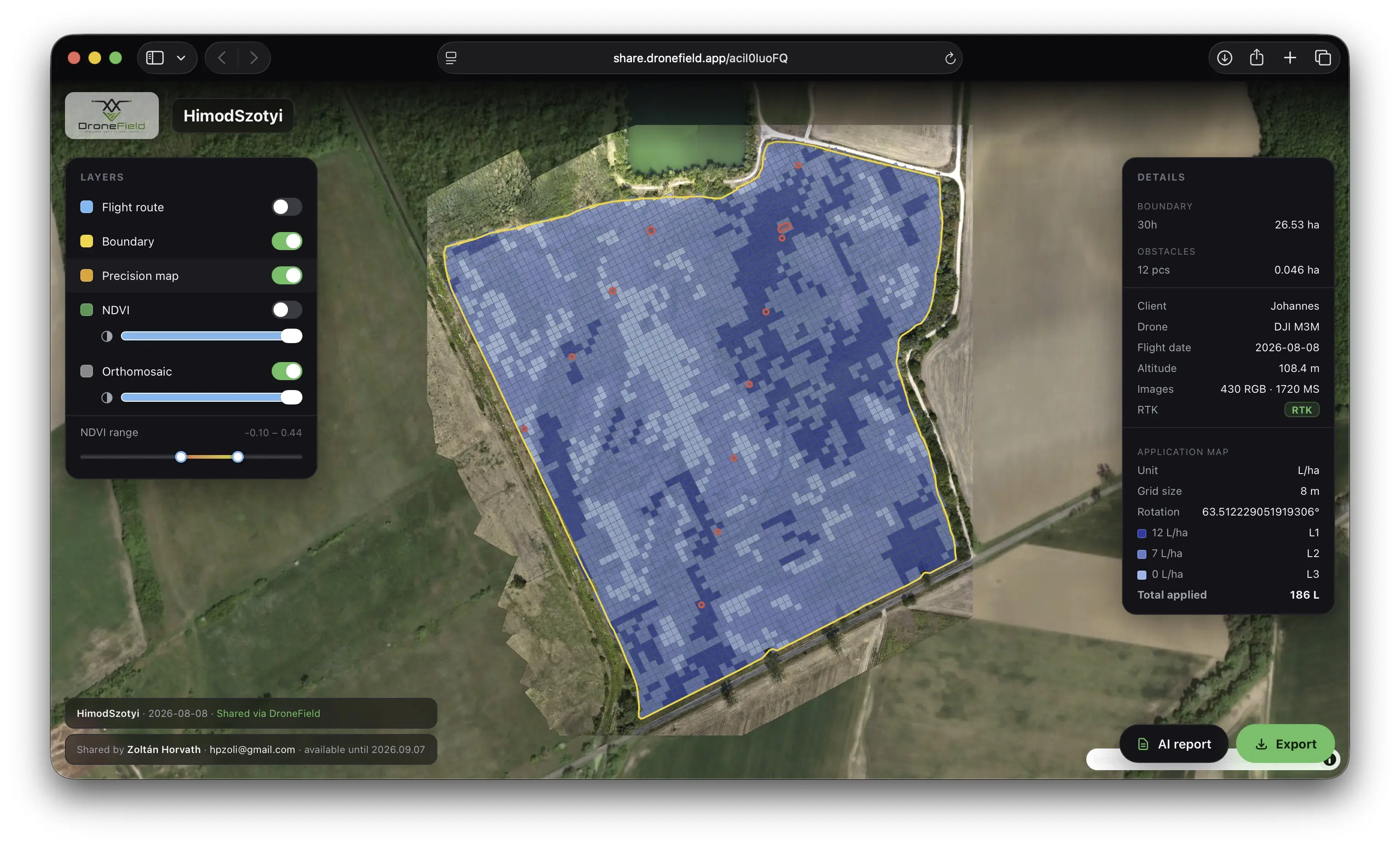
- The precision / application map with the dose zones
- The flight route of the survey drone
- The boundary, obstacles and non-spray zones
- The flight settings and survey details — drone type, flight date, altitude, image count, RTK status
- The application map parameters — unit, grid size, rotation, dose levels and total volume
- The AI Report button, when the project carries an AI vegetation analysis
The AI Report button
Section titled “The AI Report button”If the shared project was planned with AI vegetation analysis, an AI Report button appears in the web view. It opens Luna’s PDF report — the index map, the zone table with the planned doses, the agronomic reasoning and the expert-approval block.
This is how the client or agronomist reads the reasoning behind the plan without installing DroneField: you send one link, and the analysis travels with the map.
Downloads from the share link
Section titled “Downloads from the share link”The recipient can download from the web view via the Export button:
- Boundary, obstacle and non-spray zones — in ISOXML, KML and ESRI Shapefile format
- The application plan for DJI Agras, XAG and ABZ Innovation spray drones
- The AI analysis PDF report, when the project has one
So the spray-drone pilot doesn’t need any file transfer — they open the link on-site and download the plan for their own drone brand.
Lifetime & deleting
Section titled “Lifetime & deleting”- A share stays live for 30 days, then it is deleted automatically.
- You can delete it earlier at any time from the desktop application.
- On the portal the Shares page lists all your active shares — with view counts and expiry dates — and lets you open or delete them there too.
- The annual subscription includes 25 shares per user.