

AI field boundary (AI Boundary)
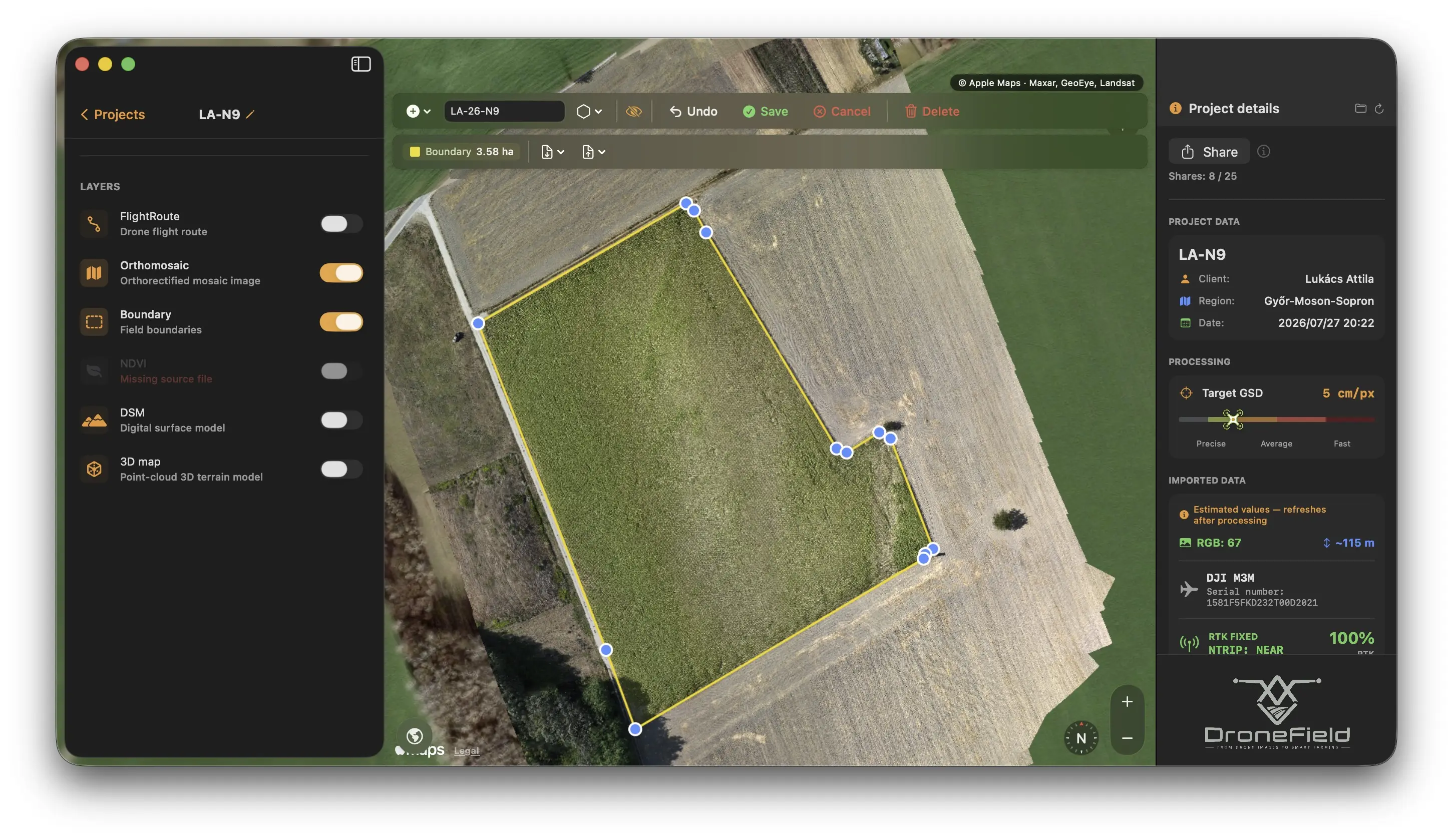
AI Boundary removes the most tedious step of field work: instead of tracing the field by hand, you simply click the field on the orthomosaic and the built-in segmentation model draws the field boundary for you.
The model runs entirely on your machine — no internet connection is needed and your imagery never leaves the computer.
How to use it
Section titled “How to use it”- Open the Add menu and choose AI Boundary. The app signals that it is waiting for a click.
- Click the field on the orthomosaic.
- The boundary is generated and becomes immediately editable.
Refining the result
Section titled “Refining the result”The generated polygon behaves like any hand-drawn boundary, plus two AI-specific tools:
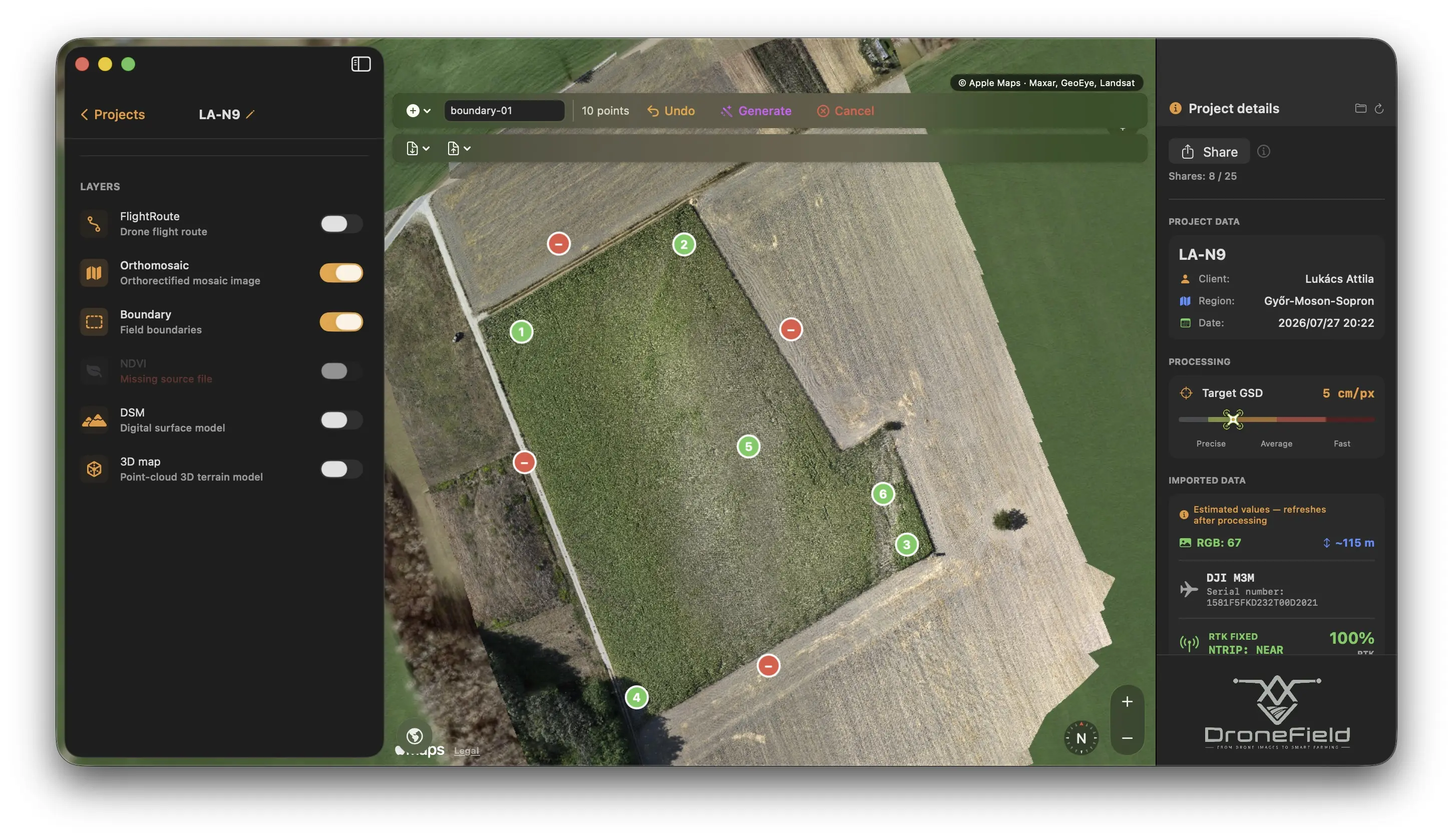
- + point — include this part too: click a region the model missed (e.g. a cut-off corner of the field). Every part marked with a + point is guaranteed to end up inside the polygon.
- − point — exclude this part: click an area that should not be treated (e.g. an adjoining green strip or tree line).
- Vertices can be dragged by hand, like on any polygon.
- ⌥ (Option)-click a vertex to delete it.
On heterogeneous, patchy fields the fastest route is usually several + points — one per bright or discoloured patch.
What the model does for you
Section titled “What the model does for you”- Runs locally — works offline; nothing is uploaded.
- Thins the vertices automatically (roughly one per 3.5–5 m). Spray drones process the polygon on board, so fewer points mean faster, more reliable uploads.
- Cuts obvious artefacts — spikes and false protrusions are removed automatically; borderline cases are left to you (+/− point, vertex editing).
Where else you’ll meet it
Section titled “Where else you’ll meet it”- AI vegetation analysis requires a boundary — if the project has none, the app offers to create one with AI Boundary.
- XAG route export — when you save an XAG route without a boundary, DroneField generates one automatically (the XAG cloud, nf.xa.com, requires it). See Field boundaries → XAG drones.